Download charts
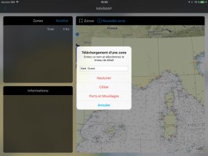
Download of charts has been completely redesigned. For each publisher subscribed, a page let you select a category of chart and draw a geographical area.
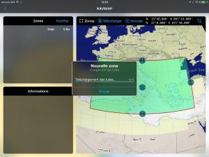
Once the category is selected and the area defined, one start the download :
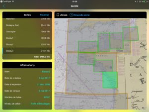
There is not limit to the number of areas downloaded, or the size of the files :
The charts are stored in memory as long as you do not delete it.
Weather GRIB
- Addition of Meteo-France AROME models Caribbean / Guyana / Polynesia / New Caledonia / Indian Ocean, 0.025 ° (1,5 MN).
- Export GRIB files.
Improvements
Several improvements have been made :
- Permanent display of coordinates latitude and longitude of a selected target or location registered. A selection of coordinates units has been added (iPad only).
- Improvement of tracks display. Trip distance on the ground has been added to the recorded tracks.
- Ability to change the names in “Edit” mode for all lists with a simple tap on the field (Location, routes, tracks, etc.).
- The selection of a stored location or activation of a target on GPS location scroll it to center of the screen.
- Addition of fine adjustments for NMEA data received from some sensors :
- Adjustment : to correct permanently the value in percentage.
- Damping : to delay data received and smooth display (scale of 1 up to 5)


