Weather4D Routing & Navigation 2.0.46
Performance, performance, performance!
The sailing season is switching into high gear and a new set of exciting innovations is coming up with the latest version of Weather4D Routing & Navigation.
The previous release included a number of safety features such as the Man Overboard (MOB) as well as community centric features like the ability to share navigation data with other fellow sailors.
This one is about performance! And not just about the app performance, it really is about improving performance on the water whether you are cruising or racing. Are you ready? Set! Go!
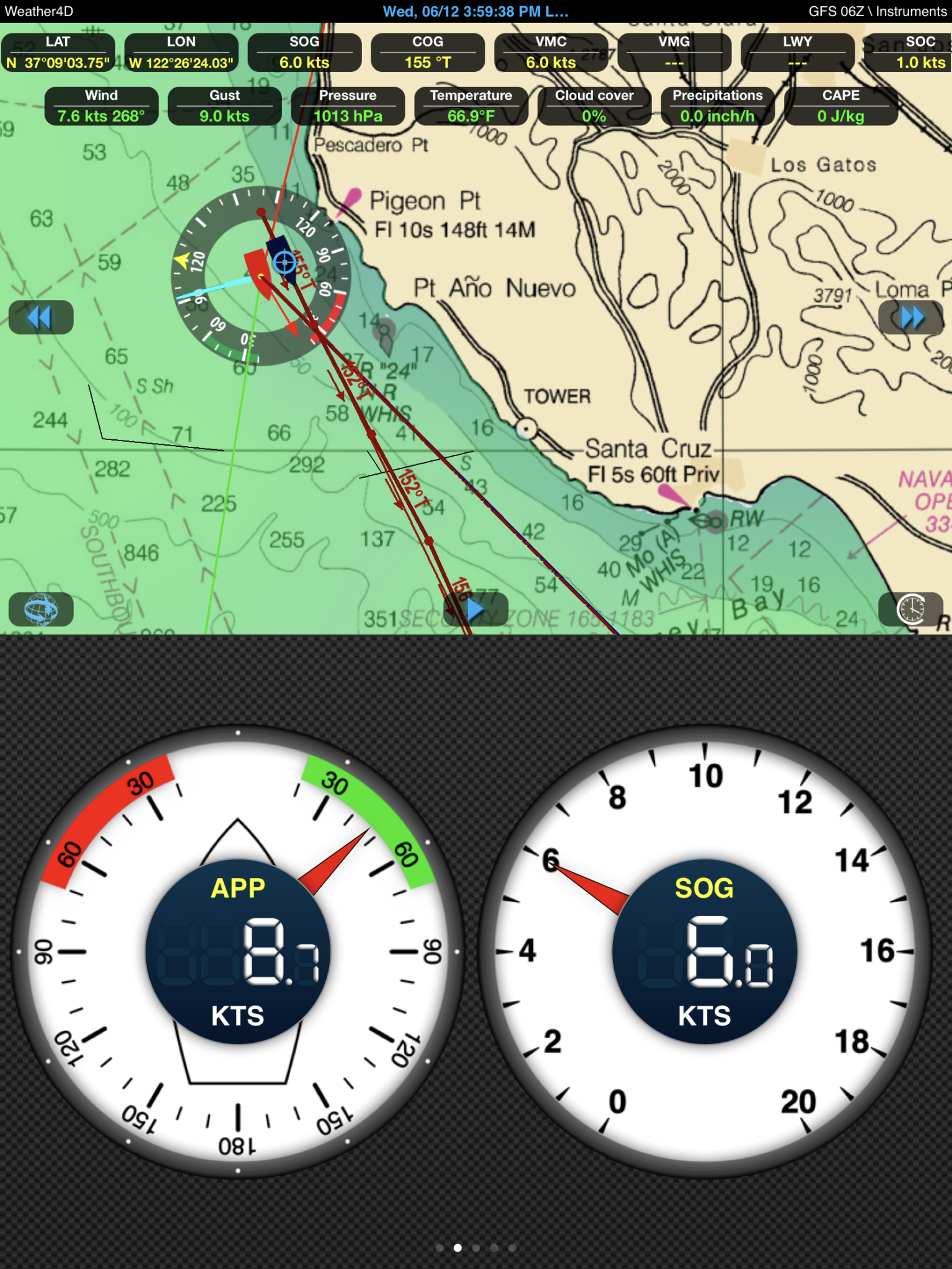
1. Laylines
A layline is an imaginary line extending from the upwind objective to indicate the point at which a boat should tack in order to just clear the windward side of the mark. This is the optimized path between two buoys.
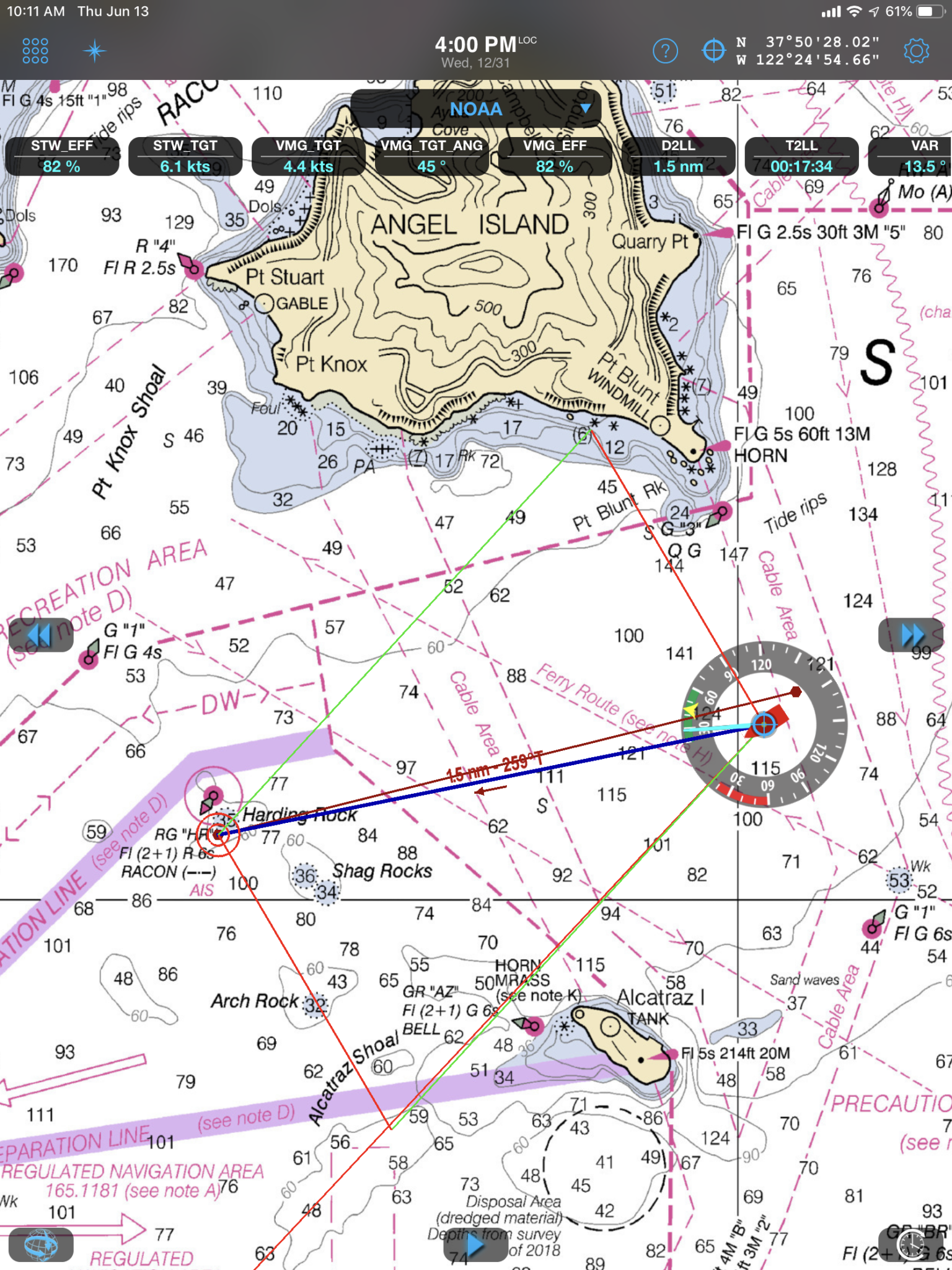
Laylines
In a regatta, a good start followed by clean manoeuvres, and following laylines give a definite competitive advantage. Weather4D Routing & Navigation can now display laylines. Enable the feature in the Global Settings. Polars are now also displayed in Global Settings to check at a glance the polar used to calculate the laylines. Other parameters include data measured by the boat sensors (AWA, HDG, STW, COG, SOG).
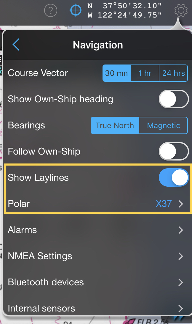
Show Laylines
![]()
2. AIS buoy support
AIS is a fantastic safety system allowing to automatically identify surrounding boats and figuring out whether or not to course correct to avoid a potential collision. Most of the time, the AIS detects a ship even before I see her in the first place even in clear weather. The good news is this system is extensible to any known “floating objects” such as buoys. This makes buoys identification a breathe. You know in realtime how far it is and how much time it will take to pass a given buoy as long as it is equiped with an AIS transmitter. Knowing exactly where the buoys definitely helps with regattas prep. It makes it easier to set waypoints close to buoys which give a “where/when to tack” indication.
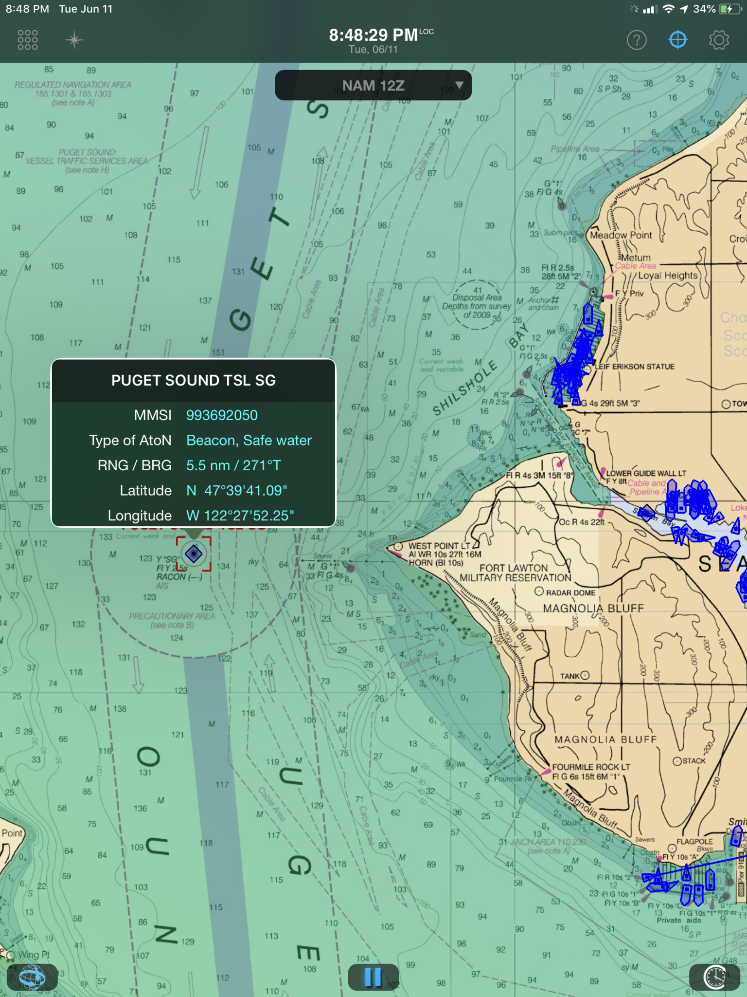
Puget Sound TSL SG
The value for cruisers is that buoys being actually smaller than ships, they are somewhat more difficult to spot. With the AIS buoy support, not only the buoy is visible on the chart but Weather4D can alert the crew about a buoy when it’s coming up close.
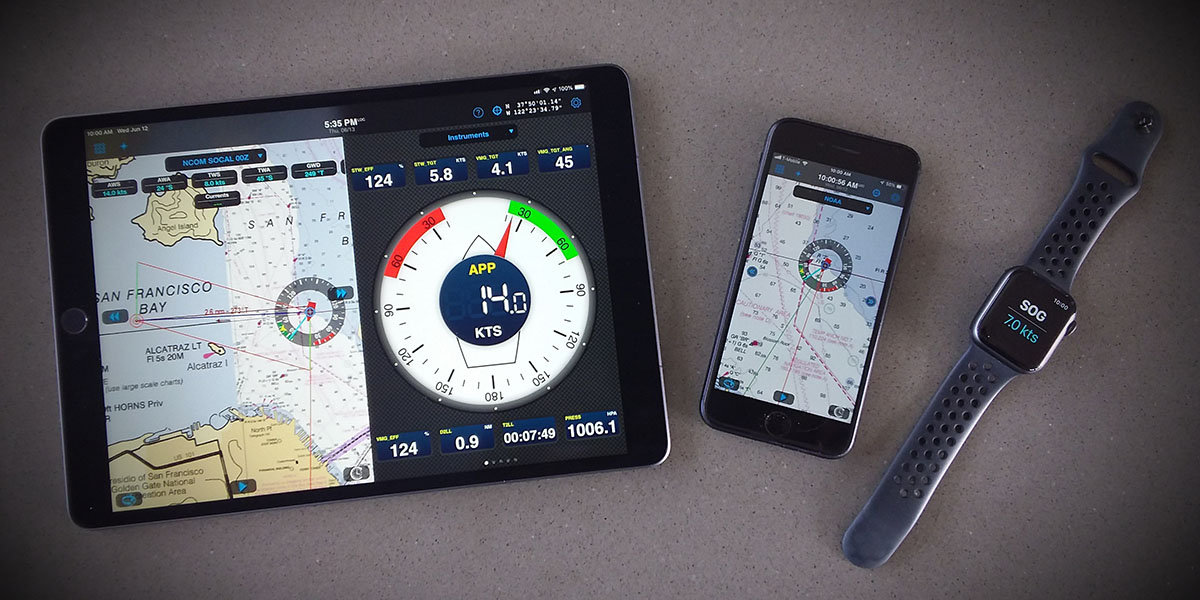
3. Boat Performance Data
Do you enjoy the thrill of competing in regattas? Getting ahead is about being fast but there is more to it and reliable perf information can help you beat the chrono and the competition. To help sailing racers, the following data is now viewable in Weather4D Routing & Navigation in realtime.
- STW_EFF / Speed Through Water Target Efficiency (Replaces PERF)
- STW_TGT / Speed Through Water Target
- VMG_TGT / Velocity Made Good Target
- VMG_TGT_ANG / Velocity Made Good Target Angle
- VMG_EFF / Velocity Made Good Target Efficiency
- D2LL / Distance to layline
- T2LL / Time to layline
- Feet & Fathoms support for DPS, DBT, DBK NMEA sentences
To display this data, enable first the Navigation mode and select a relevant target to be set as the goto target.
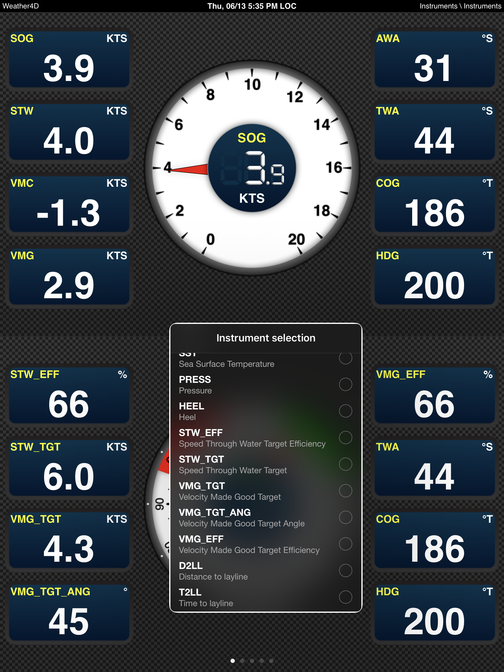
Boat Performance data
![]()
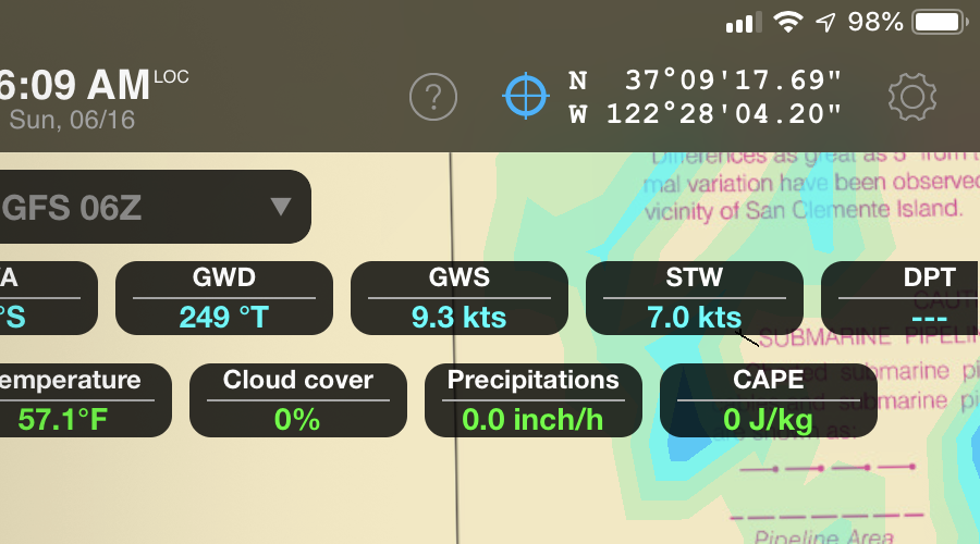
4. NMEA MMB (Pressure) & XDR (Air Temp) sentences support
Your transponder sends pressure data using MMB and Surface Air Temperature using XDR? These sentences type are now supported.
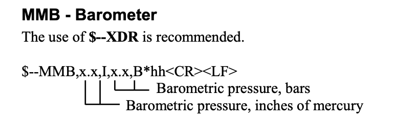
MMB
5. Routing without polar
Polars describe a boat’s performance in a variety of wind speeds at wind angles from dead downwind all the way to ~40 knots upwind. Users ask sometimes why we do not have a large set of polars available by default in Weather4D.
This is because polars are so specific to a boat and the set of sails used that there no guaranty your boat model “official” polar will match your boat performance per se.
Furthermore, in some cases a routing calculation will not require a polar. Specifically when the plan is to use the engine only or if your boat is actually a power boat. In some other cases you may just not have a reliable polar handy.
This is why it made sense to have the ability to calculate a routing without relying on a polar.

Routing without polar
6. Routing without polar simulation
Calculating a routing without a polar can be a very effective way to plan a navigation for sailboats and power boats. Simulating that routing with instruments to visualize weather conditions combined with SOG, COG, HDG, DTW, etc… at any given point in time and space is even better to project yourself (and your crew) in what’s coming ahead.
Therefore it made sense to complete the routing without polar feature with the ability to simulate it. And to keep things simple, this works the same way as a regular routing simulation. Set the blue target on the routing you want to simulate and either tap on the play button (bottom center) or tap on the temporal mode button (bottom right) and slide a finger across the screen to animate.
Routing without polar simulation
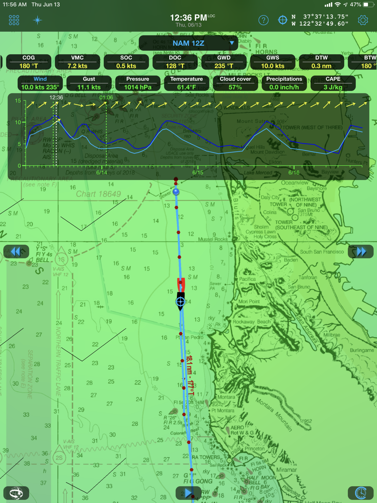
7. GWS (Ground Wind Speed) in addition to GWD
Ground Wind Speed is the calculated wind speed on shore based on data measured aboard. It requires AWA, AWS, GPS, COG, SOG and HDG. GWS is also the vector sum of the tide/current wind and TWS.
GWS GWD
On slack water TWS and GWS are the same. In tidal waters like in the Puget Sound area or in offshore currents, they are different. They affect laylines calculation and hence performance. This is yet another data point made available to enable sailors to achieve higher performance the smart way.
![]()
8. SOC DOC & GWS GWD simulation
Like routing without polar, SOC DOC & GWS GWD simulation enhances navigation planning whether you’re preparing for your next regatta or taking family and friends on a weekend sailing trip.
SOC DOC GWD GWS simulation
9. ENC charting support for Spain, Gibraltar, Canary Islands and Croatia
Sailing in Spain? Going through the strait of Gibraltar? Passing Cape Finistere? Discovering Croatia? We are super excited to announce the first ENC charts in Weather4D Routing & Navigation as a result of our our partnership with GeoGarage.
The new charts for Croatia (derived from HHI_ENC) and Spain (derived from IHM_ENC) are available for subscription on https://weather4d.geogarage.com
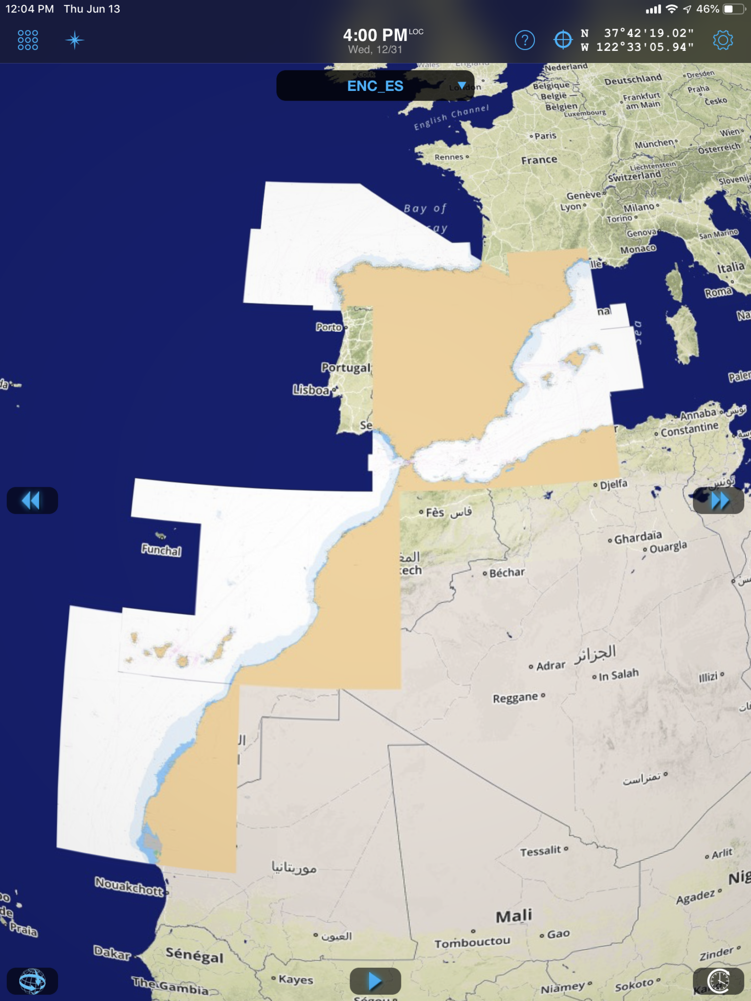
Spain charts (derived from IHM_ENC)
10. A new version of the User Guide is available on iBooks
This new User Guide edition contains all the information about the new features coming with this release and how to use them so you can be 100% prepared for your next regatta or your next cruise. You can download or update it from this link.
Weather4D Routing & Navigation User Guide
What to do now?
Visit the App Store to download or update Weather4D Routing & Navigation

Visit iBooks to download or to update the User Guide
Sailing in Spain, Gibraltar, Canaries, Croatia this summer?
Croatia (derived from HHI_ENC) and Spain (derived from IHM_ENC) are available for subscription on https://weather4d.geogarage.com
Are you a Weather4D Lite or Weather4D Routing user? Upgrade and save!
Check the FAQ page for more information about upgrades to Weather4D Routing & Navigation with bundles and pay only the difference between the price paid for your current app and Weather4D Routing & Navigation price.