NOAA
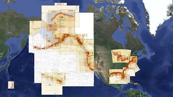
1024 cartes NOAA raster (2147 avec les « sous-cartes ») sont incluses dans la plateforme GeoGarage.
- 11389 ed36 80000 St Joseph and St Andrew Bays
- 11416 ed14 80000 Tampa Bay;Safety Harbor;St. Petersburg;Tampa
- 12221 ed84 80000 Chesapeake Bay Entrance
- 12222 ed56 40000 Chesapeake Bay Cape Charles to Norfolk Harbor
- 12372 ed38 40000 FOLIO SMALL-CRAFT CHART Long Island Sound-Watch Hill to New Haven Harbor
- 14904 ed28 120000 Port Washington to Waukegan;Kenosha;North Point Marina;Port Washington;Waukegan
- 11326 ed41 80000 FOLIO SMALL-CRAFT CHART Galveston Bay
- 11490 ed22 40000 Approaches to St. Johns River;St. Johns River Entrance
Dans l’application, si vous avez téléchargé ces cartes pour les utiliser hors ligne, tapez sur le bouton bleu pour mettre à jour les cartes concernées.
Le détail de cette mise à jour est postée sur https://geogarage.com/blog/news-1/post/us-noaa-update-273


