(Re)Discover iWatchSat
Satellites make it possible to download grib files offshore but the data transfer from a satellite is optimal only when they are positioned well and for a long enough time above your vessel.
iWatchSat tells you when a satellite is easily reachable with Iridium.
With an improved connection and signal quality, connection attempts and time to download are considerably reduced.
iWatchSat combines High Definition graphics and simplicity. It automatically identifies satellites you can potentially connect to and displays when to connect.
How does iWatchSat work?
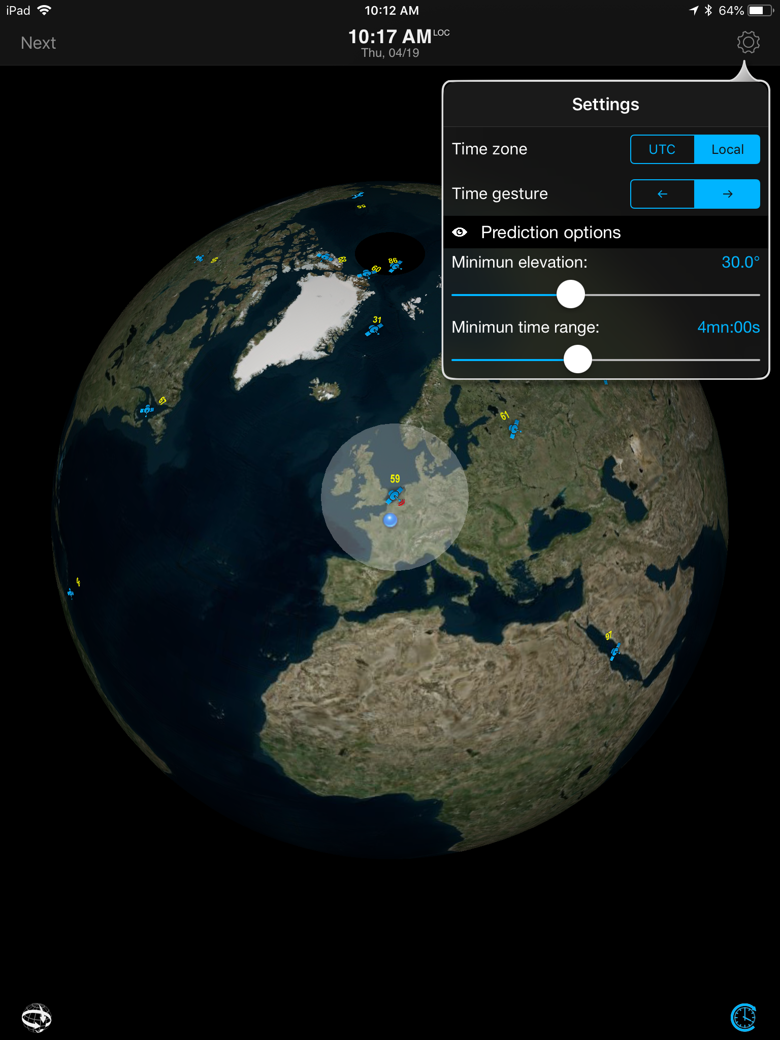
Launch iWatchSat and tap on “Next” on the upper left of the screen to display when the next satellite is reachable. Tap a second time on “Next” to display the subsequent satellite passage time.
Double tap on the Passage time on the upper middle of the screen to reset to the actual time.
Tap the Settings icon on the upper right to adjust passage prediction options.
Enable the “Clock” button on the lower right corner and slide your finger horizontally on the screen to manually scroll time back and forward.
Tap on the “Planet” button on the lower left corner to zoom in, zoom out and explore other regions for satellites.
Déjà vu ?
Our Weather4D Pro users who recently upgraded to Weather4D Routing and Weather4D Routing & Navigation know this feature very well. We’re excited to make it available by popular demand as a free stand alone app for everyone.
Please note that rain impacts connection quality even when the satellite positioning is optimal.
![]()